Accessing data on devices such as mobile phones and tablets has impacted on almost every aspect of our lives. Not surprisingly, the creation and availability of data has become a huge part of environmental, urban and transport planning. Device and mobile data is no longer simply a tool to support the planning process - it is now also part of what drives the planning process in terms of systems and design.
Digital innovation, together with greater integration of applications, is creating possibilities for new types of transport and urban systems. Capitalising on this technology is enabling consultants for transport planning, infrastructure design and environmental assessment to create the systems that will best serve us now and in the future.
Getting around
When it comes to transport planning and urban design, the aim of any blueprint is to allow people to get to where they want to go with the greatest ease in the shortest amount of time, while creating minimum pollution or disruption to those who share their urban environment, at the least expense.
That’s quite a tall order, but it’s on the agenda of every local authority as well as central government.
Successful transport planning works effectively for all users, including pedestrians, private vehicles, public transport and cyclists. It also needs to take account of social and environmental factors:
- How does the planning impact on residents and businesses?
- What about environmental factors such as open spaces, eco considerations and wildlife?
- How does the system adapt to occasions such as crowds for special events or busy periods?
Device and mobile data can not only help in getting transport planning right, but can also be used to enable ongoing adaptations through the use of device and mobile apps.
A two-way process
The use of mobile and device data to drive planning is built on a two-way process: the passenger receives useful information from service providers and local authorities, while simultaneously providing information and statistics on how they use those systems.
From hand-held devices used by traffic wardens to ticketing systems at shopping and leisure centre car parks, smart data systems can gather information for future planning while giving instant assistance to users of smart devices. By accessing information on personal devices, commuters and other travellers can act on information that will improve traffic flow, while also making the use of public transport a more attractive alternative to private cars.
The transport planning process is therefore able to engage with the end user of the scheme by gathering real-time data on how we all move around our environments.
Traffic surveys
Successful transport planning and infrastructure design starts with the surveys that gather the vital stats and data that will support the planning process from the outset.
Apps for undertaking traffic surveys offer much greater detail than was previously possible. Such apps also process the data and make calculations, bringing greater clarity to the planning process.
JCT Consultancy are one of the leaders in this field. They’re best known as the creators of LinSig, a widely-used piece of junction modelling software that enables transport planners to model traffic signals and their effect on traffic capacities and queuing.
JCT have more recently created JCT TrafficTools, a free app for conducting traffic surveys.
Previously, surveys would be conducted by keeping a tally of traffic on paper, then taking it back to the office to input data and work on the calculations. The TrafficTools app makes the process easier through a simple interface, where traffic surveyors click the type of vehicle as it passes them. It then automatically calculates a number of the numerical figures required for a LinSig junction model, such as degree of saturation, converting vehicle tallies into PCUs (Passenger Car Units), and so forth.
TrafficTools can save the site location by GPS coordinates, allows for pictures of the survey site, and can email the data back to the desktop immediately, streamlining the whole process of conducting a traffic survey.

Smart data for public transport
The use of smartphones has become a significant part of successful public transport systems. Mobile ticketing and contactless card payments have had a positive impact on bus loading times. Passengers can buy tickets on-the-go, choosing a tariff that suits them (such as single or multiple journeys, weekly or daily passes). The process is complete before boarding.
Data on smartphones can also guide passengers to the best method of reaching a destination, whether it’s a particular bus, train or tube, or a combination of two or more forms of transport, including walking.
Smart data on mobile devices has managed to eliminate one of the major turn-offs to using public transport, namely, the time-wasting spent standing at a bus stop for half an hour or more in all weathers, waiting for the bus. Smart data gives minute-by-minute information of bus arrival times at individual stops so that passengers can go to their stop just a couple of minutes before boarding. It makes buses a much more attractive option.
Planning for real people
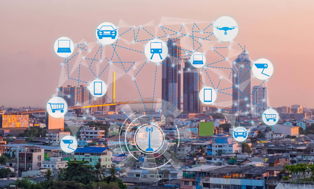
We are seeing the creation of ‘smart cities’, where planners use data from multiple sources to make city travel appropriate to those who live and work there, and who use the city’s services and facilities.
Integrating that data can transform mobility in cities. Data comes from multiple sources including car park payment terminals, traffic cameras, and tweets by commuters as they make their journeys. Integrated data can create Intelligent Transportation Systems (ITS) which are increasingly becoming a feature of successful urban planning. The recent Huawei UK Smart Cities Index named Bristol, London, Manchester and Birmingham as the UK leaders in using smart data to drive successful planning that delivers both economic growth and improved quality of life.
We live in a world with ever growing demands on our transport systems and urban centres. In order to understand these demands and create transport systems that deliver effective and long-term solutions to a growing population, we need to be fully informed. Through the gathering and integration of essential data, which can be used by transport planners and the public, whatever their requirements, we can design transport systems, highway infrastructure and urban environments that best serve all our needs.